Improving Surface Current Estimation From Geostationary Ocean Color Imager Using Tidal Ellipse and Angular Limitation
Date of Issue:2022-04-12
Reading:1213
Chen, J., J. Chen, Z. Cao and Y. Shen. Improving Surface Current Estimation From Geostationary Ocean Color Imager Using Tidal Ellipse and Angular Limitation. Journal of Geophysical Research: Oceans, 124. https://doi.org/10.1029/2019JC015027
Sea surface currents (SSCs) in coastal regions can be mapped from successive optical images observed by satellite. We implemented the maximum cross‐correlation (MCC) algorithm to Geostationary Ocean Color Imager‐derived total suspended matter in the East China Sea in this study. We developed a new data filtering method to improve the accuracy of SSC vector sequence using estimated tidal ellipse. The proposed method eliminated spurious vectors by considering direction order and suitable angular limitation. The obtained average velocity of SSC reached 0.72 m/s, which was close to the buoy‐measured average speed of 0.64 m/s. Compared with existing spurious vector eliminating method, the average angular error was improved significantly by 28–38% and the average relative magnitude error was improved by 3% in the case study.
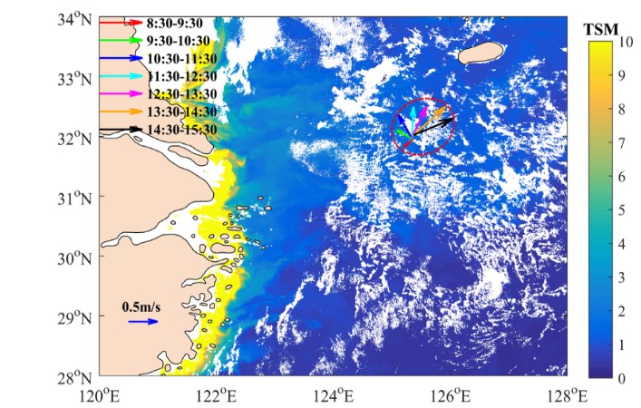
Fig. 1 The daily surface vectors of the drifting buoy on 11 August 2013, with background distribution of GOCI-derived TSM. The red dashed ellipse is estimated from SSC vectors.
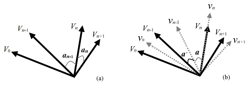
Fig. 2 Illustration of direction judgement (a) and tidal ellipse-based fitting model (gray dashed arrows) for angular limitation calculation.
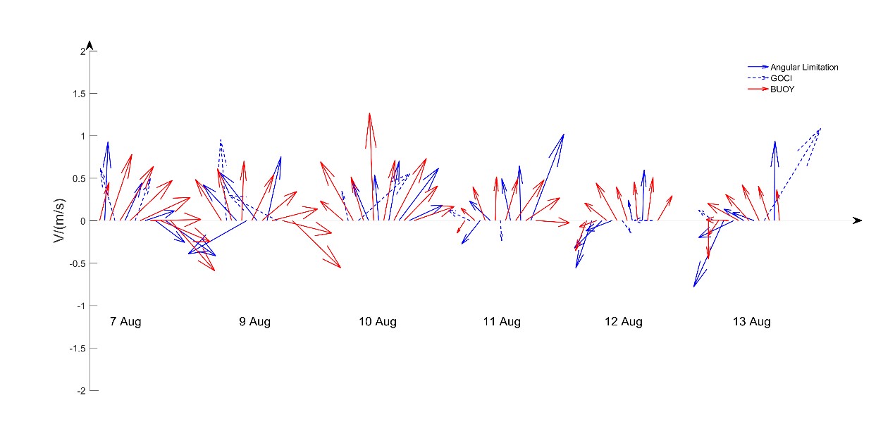
Fig.3 Observed SSC vectors from drifting buoy (red arrows) and estimated from GOCI (blue arrows) on 7, 9, 10, 11, 12, and 13 August 2013, when the corresponding location in the GOCI image is cloud free and the satellite data were of high quality. The blue solid arrows remained under the angular limitation, and the dashed arrows indicate the spurious vectors.


